Grand Rapids area tree fruit update – May 17, 2022
After a record-setting warm week, expect a return to cooler than normal conditions.
Weather and phenology update
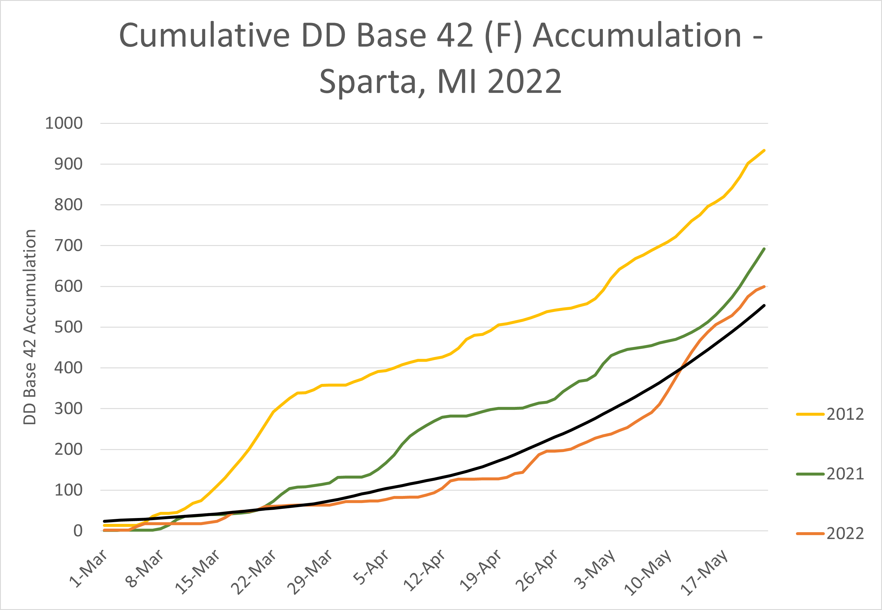
The past week was “unprecedented” in terms of heat in the Grand Rapids, Michigan, area, as well as across the state. As of May 16, the Michigan State University Sparta Enviroweather station has accumulated 502.9 growing degree days base 42 degrees Fahrenheit (GDD42). This is above average (for the first time this year!), which is 459 GDD42, and approximately four days ahead of normal.
Temperatures were hot over the past week. High temperatures were in the upper 80s from Wednesday through Saturday, with low overnight temperatures in the upper 50s to 60s. Average high temperatures were over 15 F above normal across much of Michigan. Very little rainfall occurred, with very isolated incidence of showers across the area on Saturday during the day and in the evening.
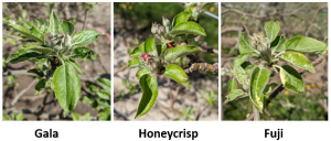
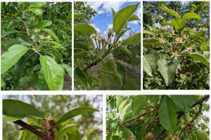
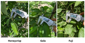
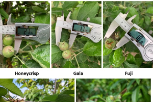
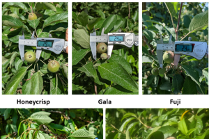
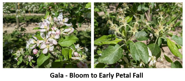
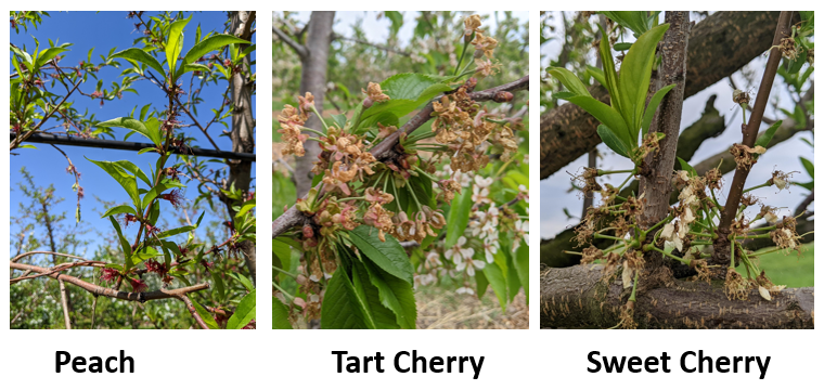
As a result, phenological development has been rapid. Most varieties of apples moved into king bloom by Thursday to Friday and full bloom over the weekend. Gala, fuji, and Honeycrisp are currently in late bloom to petal fall and are expected to remain so for the rest of the week. Early varieties such as Ginger Gold and Zestar are at petal fall and fruit size is near 6 mm. Peaches are past bloom, with fruitlets developing and still in the shuck. Tart and sweet cherries are also past bloom, and still in shuck stage.
In the coming week, expect a return to cooler than normal conditions and an associated slowdown in growth. High temperatures for most of the week are only forecasted to be in the upper 50s to 60s, with lows in the 40-50s. On Wednesday, precipitation is likely to begin early and continue throughout the day, with expected accumulation of 0.25 to 0.5 inch. Thursday is expected to be dry, with warming temperatures, forecasted highs in the 70s. This will be followed by warmer weather Friday and showers possible late in the day and overnight. Weekend conditions and the beginning of next week will return to cooler than normal, highs in the low 60s, and little precipitation.
|
Degree day accumulation at Enviroweather stations in the Grand Rapids area |
|||
| Weather Station | Degree Days Base 32 from Jan. 1 | Degree Days Base 42 from Jan. 1 | Degree Days Base 50 from Jan. 1 |
| Aetna - Fremont | 972.9 | 480.6 | 253.7 |
| Alpine | 1025.7 | 504.1 | 275.8 |
| Belding | 1010.2 | 496.6 | 262.5 |
| Clarksville (CRC) | 1053.9 | 513.4 | 266.8 |
| Conklin | 1036.2 | 508.9 | 264.5 |
| Fremont | 992.6 | 486.9 | 258.2 |
| Grant | 1020.3 | 506.4 | 570.3 |
| Kent City | 1001.7 | 493 | 261.2 |
| Reeman-Fremont | 992.7 | 482.3 | 254.2 |
| Sparta | 1020.8 | 502.9 | 265 |
| Sparta 20m Tower | 1031.8 | 507.8 | 267.2 |
| Sparta - North | 1028.4 | 507.5 | 567.8 |
| Standale | 1105 | 551.8 | 296 |
| Average DD from Sparta historical data for Jan. 1 to date | 1025.1 | 459 | 213 |
| Comparative Date of Averages @ Sparta | 16-May | 20-May | 22-May |
| Days +/- Average @ Sparta | 0 days | + 4 days | + 6 days |
For these updates, we used averages for 1997-2021 from the Michigan Automated Weather Network (MAWN) to represent normal conditions. Weather data was gathered from MSU Enviroweather.
More information and reports on normal weather conditions and departures from normal can be found on the NOAA Climate Prediction Center website, NOAA U.S. Climate Normals website, NOAA Climate Normals Quick Access Page (which may be searched by region) and Midwest Regional Climate Center website.
Pest update
Temperatures were favorable for insect and diseases in the past week. With open bloom the risk for blossom blight from the fire blight bacteria. When running the forecasted temperatures through the MaryBlyt model, the risk is mostly low going forward – if it is as cool as forecasted. You can track potential fire blight risk of blossoms 24/7 using your nearest MSU Enviroweather station. Cooler temperatures in the forecast will reduce the fire bight potential significantly. Apogee or Kudos applications should be used in high fire blight risk blocks – prohexadione calcium has kept fire blight at bay many times in the past and should be a routine part of your overall fire blight management program.
The next rain event will likely discharge a very large number of apple scab ascospores. Having a protectant fungicide applied is highly suggested ahead of the next rain event. Be cautious of stretching protectant fungicides too much as we all know the forecast is often inaccurate at predicting pop-up showers. With a good deal of fresh, green tissue showing in apples, the risk for primary scab is a concern with any rain event from now until at least the first week of June.
The hot and humid weather in the past week was ideal for powdery mildew. Continue to maintain mildewcides through at least first cover.
Many common apple pests became very active with the warmer weather and some biofix dates will likely be set – more on this in next week’s update. Warm weather moved us through bloom quickly into petal fall in some cultivars. When you apply your petal fall sprays, be mindful of bees in neighboring blocks that still might be present.
Plum curculio activity spiked in early setting tree fruits with the warm night temperatures. Be sure to not stretch your petal fall applications out too much or significant PC damage could occur.


 Print
Print Email
Email
