Grand Rapids area tree fruit update – May 25, 2021
After a very hot, dry week in the region, much cooler weather and precipitation is expected.

Weather update
Over the past week, the conditions in the Grand Rapids, Michigan, area were extremely warm and dry. Average temperatures were nearly 15-20 degrees Fahrenheit greater than normal. High temperatures reached into the 80s several on days and lows remained in 60s on a majority of nights. As a result, we are once again more than a week ahead of normal heat accumulation for the season. The Michigan State University Sparta Enviroweather station has accumulated 724.7 growing degree days (GDD) base 42 since Jan. 1, which is approximately eight days earlier than the average for May 24.
A shift in weather is predicted for the coming week, as a cool front moves into the state. Temperatures will be cooler than seasonal averages, with highs only in the 60s from the middle of the week through the weekend. Isolated frost in low lying areas is possible on Friday and Saturday mornings.
Extremely dry conditions persist in the Grand Rapids region, like in most of the rest of the state. Scattered showers Sunday evening into Monday brought a little rainfall. Between 0.15 and 0.3 inches of accumulation was recorded at Enviroweather stations throughout the region. Over 75% of the state continues to be under a moderate drought or classified as category D1, according to the NOAA U.S. Drought Monitor classification scale. However, the precipitation outlook is much more promising for this week. Showers are forecasted, with strong confidence, for Wednesday evening and again Friday into Saturday, with accumulation of 0.25-0.5 inches anticipated. The slow steady showers that are expected should provide a meaningful rain with good conditions for permeating dry soil.
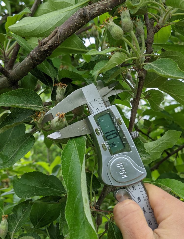
Most varieties, including Gala, Honeycrisp and Fuji, are beginning fruitlet growth and nearing 10 millimeters in diameter. Thinning conditions are somewhat challenging this season. The hot weather during the past week provided conditions for high efficacy of thinning materials during the petal fall thinning period. This has led to very good, possibly over aggressive thinning. Many opted for more cautious thinning or waiting to thin during this period. Cool conditions during the coming week will only provide marginal thinning during the 10-12 millimeter window.
As we enter this critical thinning period, use the Apple Carbohydrate Thinning Model to adjust thinning rates each day based on weather conditions, which is available on the Enviroweather website, the Network for Environmental Weather Applications (NEWA), and the Malusim app. In addition, the Fruit Growth Rate Model can be used to determine whether make additional thinning applications. This model is also available on the Malusim app. Further instructions for both of these models can be found in this presentation Introducing the Malusim app.
When it comes to apple thinning, it can be a challenge to determine the actual volume of a product to include in a tank mix. The article “Spray mixing adjustments for thinning” from MSU Extension provides some guidance.
Pest updates
Dry conditions remain and temperatures have been much above normal over the past week. The rollercoaster weather ride continues.
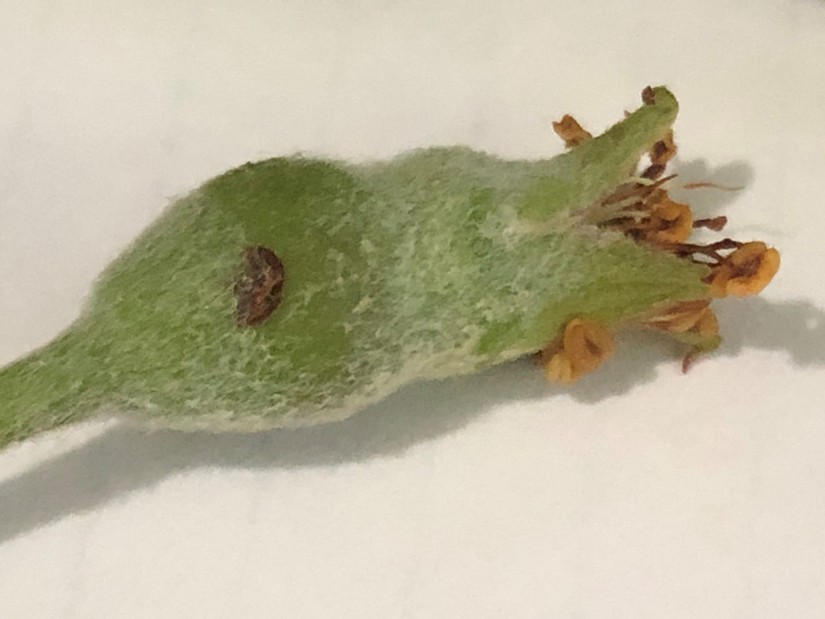
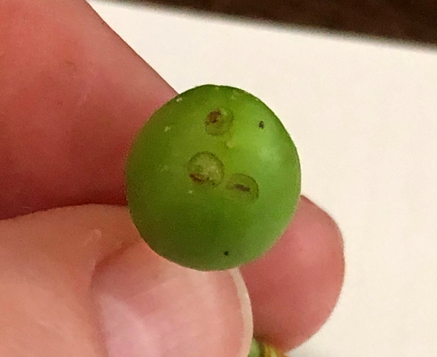
With the very warm nighttime temperatures, plum curculio is now active. The small, developing fruits of plum, peach and apple are in the perfect stage now for plum curculio’s liking and are prime targets.
The following photos were taken at 11 a.m. on May 25, 2021, from unsprayed apple and plum in the Sparta, Michigan, area. The egglaying scars are very fresh and likely occurred in the past night or two.


Oriental fruit moth adults continue to fly and trap numbers are steady or declining. A biofix was set for the general Grand Rapids area for May 1. The Sparta MSU Enviroweather station has accumulated 298 GDD base 45 since that biofix. Early egg hatch for oriental fruit moth began over the last week and cover sprays to prevent shoot infestation in stone fruits are needed. Peak egg hatch is expected around June 1 in the general Grand Rapids area.
The warmer night temperatures are ideal for codling moth flight. A biofix for the Grand Rapids region was set for May 16. The degree day totals for base 50 since that biofix are totaling 141 and egglaying should be well underway. Early egg hatch and the timing for materials aimed at small larvae will likely be about 10 days from now or around June 3 for the general Grand Rapids area.
San Jose Scale males began first flight over the past week. A regional biofix for the general Grand Rapids area was set for May 20 with 67 degree days base 51 accumulated since that date. Cover sprays to target San Jose crawlers are at least three to four weeks off—typically around the third week of June.
Apple scab primary ascospores should be 100% mature. Now we need some decent rain events to release all mature spores. With the very unusual dry spring in 2021, the discharging of primary apple scab spores has been unlike any other year in recent memory. It is likely primary apple scab will end on the early side, but dry conditions might play a role in drawing out the spore release. Despite the very dry spring, scab lesions can be found readily in unmanaged apples. There are a few reports of scab in commercial blocks as well. Be cautious of stretching fungicides too much. With a good deal of fresh, green tissue and tiny apples present, the risk for primary scab is a concern with any rain event from now until at least the end of May.
Fire blight risk remains high for any bloom still present in susceptible apple cultivars. Keep a close eye on your nearest MSU Enviroweather station for infection potential if you still have bloom present. If any storms bring high winds or hail, the risk for trauma blight will also come into play.


 Print
Print Email
Email
