Northeast Michigan field crop regional report – May 14, 2015
Field work continues between past and predicted showers.

Weather
A handful of wet days between Friday, May 8, and Monday, May 11, temporarily halted growers’ progress in the field. However, many took this opportunity to adjust equipment or procure inputs, and crop condition is now improving on account of the needed moisture. Field operations resumed in most areas Wednesday, May 13, with manure applications, tillage and planting of corn and potatoes. Winter annual weeds such as henbit and shepherd’s purse are blooming, as are dandelions. Pre-plant herbicide applications are also beginning to take effect. Statewide planting progress across all crops is ahead of the five-year averages for this point in the season.
Rainfall
Approximately 0.8-1.92 inches of rain fell in northeast Lower Michigan last Friday, May 8, through this Monday, May 11, ending a two week dry spell across the region. With recent precipitation, this spring season is now only slightly drier than average (0-1 inches or 0-20 percent). Our short-term forecast includes significant chances for showers and thunderstorms this Friday, May 15, and early next week, May 17-18. These precipitation events could deliver as much as 1 inch of additional rainfall. Yet, the six- to 10-day and eight- to 14-day outlooks from NOAA indicate that northeast Michigan will experience near to slightly below normal precipitation in the next few weeks.
Growing degree days (GDD)
Daily high air temperatures over the last week have ranged from 50 to 89 degrees Fahrenheit with nighttime lows between 32 and 52 F. GDD accumulations since March 1 total 667 base 32 F, 334 base 41 and 146 base 50. These totals are as much as three or four calendar days ahead of the 30-year average for this time of year. A warm front will bring temperatures in the mid-70s to 80 F over the weekend ahead, May 16-17. This will be followed closely by a cooler air mass that is expected to moderate temperatures somewhat, with highs struggling to reach the upper 60s through the rest of next week. The medium range outlooks from NOAA suggest that, after this cold spell, temperatures will soon shift to trend slightly above normal in coming weeks.
Commodity reports
Winter wheat has greened up in response to recent precipitation and nitrogen fertilization. Most stands range in development from Feekes stage 5 to 6, with the first joint still not visible in northernmost locations. Areas of poor establishment or winter injury are now more apparent in otherwise even fields, but overall crop area affected is relatively limited. Herbicide applications are beginning, and the window for growth regulators such as 2, 4-D will close quickly. Growth regulators must be applied before jointing (Feekes 6 growth stage) in order to limit crop injury. Later application can result kernel abortion, ultimately reducing yield. ALS inhibitors can be applied until just before the flag-leaf is visible (Feekes stage 7.9).
No true armyworm moths have been trapped at our monitoring site in Presque Isle County and no catches have been reported from the southern Lower Peninsula, suggesting that the flight has not begun.
Alfalfa has also benefited from recent rains. Plants are 7-15 inches tall and have five to seven fully expanded trifoliate leaves. The crop is nearly half-way to first harvest at approximately 25-27 percent NDF. Michigan State University Extension recommends beginning harvest of dairy quality alfalfa at the mid-bud stage, which normally coincides with the accumulation of 750 base 41 F GDD (currently 334 base 41).
Drilling of new alfalfa and mixed hay seedings continued late this week, but germination has been slowed by relatively cool soil temperatures. Cool season forage grasses are 8-18 inches tall.
Oats were sown in a number of fields before the rain came last weekend. The earliest planted stands are emerging and appear to be in good condition. Planting of spring oats and other small grains like barley will continue through the next week.
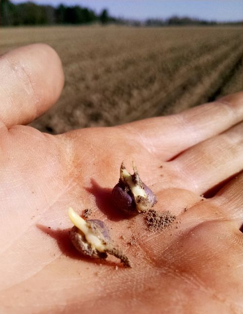
Approximately 60-70 percent of our intended corn crop has been planted in northeast Michigan with the speediest growers finishing late this week (May 14). A few isolated acres are spiking (VE stage). However, cool weather early this week has slowed emergence of most early planted corn. Growers will want to watch their fields for stand establishment issues related to cool soil temperatures, but germination appears to be consistent in most fields.
A number of upland acres were planted to soybeans and potatoes in the last week across northeast Michigan. Some local growers have as much as 30 percent of their soybeans in the ground, and statewide 32 percent of our anticipated soybean crop has been planted. No emerged soybeans have been observed or reported.
No dry beans have been planted in northeast Michigan.
Other Michigan State University Extension field crop regional reports from this week:


 Print
Print Email
Email

