Northeast Michigan field crop regional report – May 28, 2015
Recent rains slowed field progress, but crop development and conditions are good.

Weather and rainfall
Approximately 1.4-2 inches of rain fell across northeast Michigan early this week, Sunday, May 24, through Tuesday, May 26. The majority of this precipitation came early Monday, May 25, when a sluggish warmfront arrived from the southwest. Total precipitation in the last 30 days has been 90-125 percent of our 30-year regional mean according to the State Climatologist’s office. Rainfall at the Michigan State University Hawks Enviro-weather station is approximately 1 inch above the five-year average for the last month. Wet soils have kept many growers out of the field in recent days and slightly delayed the anticipated completion of field preparation and soybean/potato planting operations.
Another slow moving frontal boundary is expected to enter our region late Friday, May 29, delivering an additional 0.5-1.25 inches of rainfall before moving out to the east Saturday evening, May 30. However, the first half of next week is expected to be clear and dry. The six- to 10- and eight- to 14-day outlooks from NOAA indicate a slight chance for above normal precipitation in coming weeks.
Growing degree days (GDD)
Daytime high temperatures have felt more seasonable over the last seven days, ranging from 56 to 86 degrees Fahrenheit and averaging 74 F. Nighttime lows, on the other hand, dipped below freezing on two occasions late last week. Warm days have since hastened the recovery of several crops touched by frost and further advanced our current lead on the average spring in terms of GDD accrual. GDD accumulations since March 1 total 1,040 base 32 F, 584 base 41 and 290 base 50.
Most of northeast Michigan is approximately three days to one calendar week ahead of the 30-year average for GDD accumulation at this point in the season. However, a Canadian air mass is forecast to drop average daily temperatures by 20-plus degrees beginning this weekend, and inland locations are at risk for another round of patchy frost the evenings of Saturday, May 30, and Sunday, May 31. Temperatures will then trend upward through next week, reaching the upper 70s by Wednesday, June 3. The sixe- to 10- and eight- to 14-day outlooks from NOAA indicate that our region will likely experience slightly above normal temperatures in the mid-term.
Commodity reports
Most winter wheat in our region now has one or two nodes visible on the main stem (Feekes stage 6-7). The developing head can be observed by splitting the main stem above the highest node, and is expanding rapidly in most cases due to recent warm days. Crop condition is strong overall with 67 percent of wheat rated as good or excellent statewide. Some cases of nitrogen deficiency and slight herbicide injury have been observed, but fungal leaf disease pressure is exceptionally low. Late herbicide applications will wrap-up in the next week or so as we approach the flag leaf stage (Feekes 8).
Three true armyworm moths were trapped at our monitoring site in Presque Isle County over the last week, yet catch numbers have been well below threshold statewide. Insecticide treatments for this pest should not be necessary.
Alfalfa in our region is 16-21 inches tall and entering the early bud stage of growth. Neutral detergent fiber (NDF) concentrations should be in the range of 29-33 percent. We have accumulated approximately 584 base 41 GDDs and are forecast to reach 650 by next Tuesday, June 2. Orchardgrass and bluegrass are heading. Harvest of alfalfa and mixed hay will likely begin in the next two weeks, if not sooner.
Alfalfa weevil adults have been observed in the field, but tip feeding injury by larvae has yet to accelerate significantly. Most forage producers in our region should be able to avoid an insecticide application by taking their first cutting before weevil populations reach threshold. Growers are beginning to look at herbicide options for new seedings, and are encouraged to consult the “2015 Weed Control Guide for Field Crops” by Michigan State University Extension.
Nearly all of northeast Michigan’s 40,000 corn acres have been planted. The crop ranges in development from barely spiking to two true leaves (VE-V2). Corn that emerged prior to last week’s frost was injured in many cases, but not killed. Even those plants that lost most of their above ground leaf tissue to the cold are quickly recovering, thanks to warm, daytime temperatures.
Now is a good time for corn growers to assess stands in their fields. This can be accomplished by counting the number of viable plants in several sample areas 1/1,000 of an acre in size (17 feet, 5 inches of row in 30-inch rows), calculating the average of those samples and multiplying that number by 1,000 to determine the per acre count. Stand counts within 10-15 percent of the field’s seeding rate are considered acceptable. While completing a stand count, it is also advisable to take note of any weed, disease or insect issues encountered.
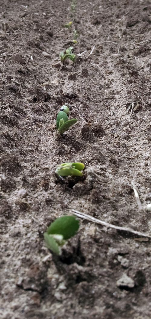
Soybeans are approximately 80 percent planted in our region. Many earlier planted stands have emerged and range in development from just cracking through to fully unrolled, unifoliate leaves (VE-VC). No reports of significant seedling disease have been received. Planting will wrap-up over the next one to two weeks. Early herbicide applications will also be made to no-till fields and other areas where pre-emergent weed control was limited once the ground dries enough to permit wheel traffic.
Rapid progress was made in potato planting late last week. Growers that started early are 60-70 percent planted while others are waiting to finish with soybeans before moving on to potatoes. Shoots are likely emerging in some of the earliest planted fields. Our Presque Isle County potato variety trial will be planted in the next week, including thirty russet, red, yellow and white table stock varieties.
No dry beans have been planted in northeast Michigan.


 Print
Print Email
Email