Northwest Michigan fruit update – April 28, 2026
 Print
Print Email
EmailSunshine and rain have moved crops along slowly as temperatures remain on the cool side. Growers are accomplishing spring tasks with the slow start to the season.
Weather report
The weather continues to waver back and forth as usual for spring in northern Michigan. We have had some warm days, and on April 23, we hit almost 78 degrees Fahrenheit during the day. We also hit a high of 45 F on April 26. This back-and-forth swing of spring temperatures is “normal” for our region, but thankfully, we have not dipped below freezing since April 19-20.
Sometimes it is surprising when we look at growing degree day (GDD) averages. As humans, we think we should be moving toward spring/summer, but the degree days show us where we truly are into the field season. We have accumulated 249.1 GDD base 42 and 106.3 GDD base 50. These numbers are ahead of our 36-year average: 185.8 GDD base 42 and 76.1 GDD base 50.
We have had some dry days, but the humidity levels even on days without rainfall seem high. The grass is really greening up, likely due to all the previous rain. We saw the lowest humidity levels of the past week on April 22 and April 20 where the humidity reading was only 52.8% and 53.2%, respectively; almost all other days have had humidity up over 65%. The Northwest Michigan Horticulture Research Center Enviroweather station recorded 0.2 inches of rain on April 24. We had more rain the morning of April 28, where another quarter inch of rain is forecast. After this morning, there may be continued drizzle, but most significant rainfall will be done by mid-morning. April 2026 is shaping up to one be the wettest months on record.
According to Jeff Andresen, PhD, we are going to see a weather change from the wet weather to a drier outlook for the state through early next week. There is a trough over the eastern part of the country, and this pattern will result in cooler and drier weather. The beginning of May will be cool. Thursday, Friday, Saturday and Sunday for the remainder of the week will be cool and dry as well. There is a potential freeze event, or at least a frost event, on Friday and Saturday mornings, May 1-2. The medium range forecast is still predicting to be cooler and drier as we move into the second week of May.
Crop report
We have had some warm daytime temperatures and cooler days. We hit a high of almost 78 F on April 23 then the daytime high on April 25 was only 42. As a result of these fluctuating temperatures, crop development is not markedly different from last week, even though we have moved along slowly.
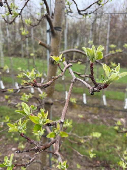
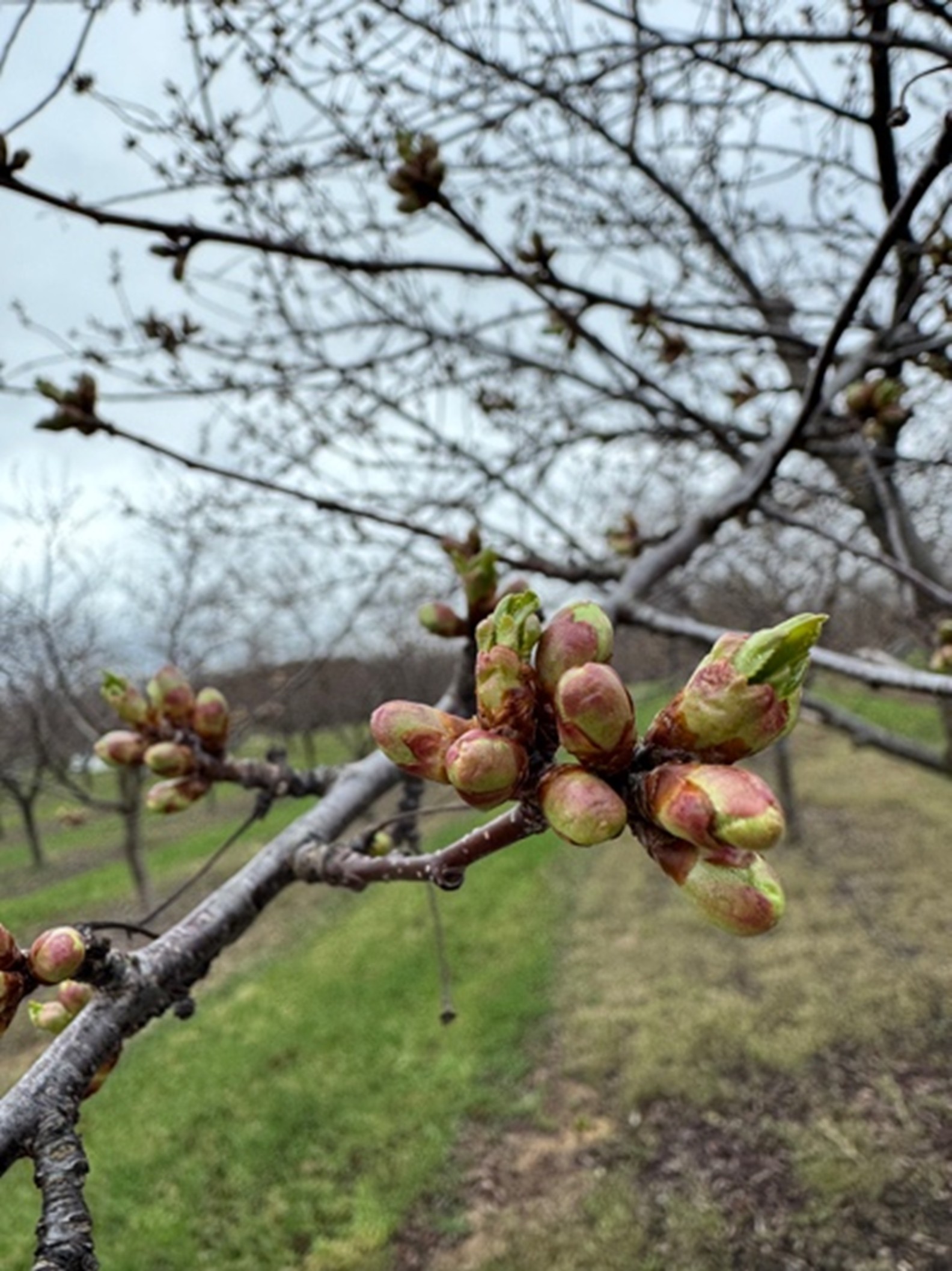
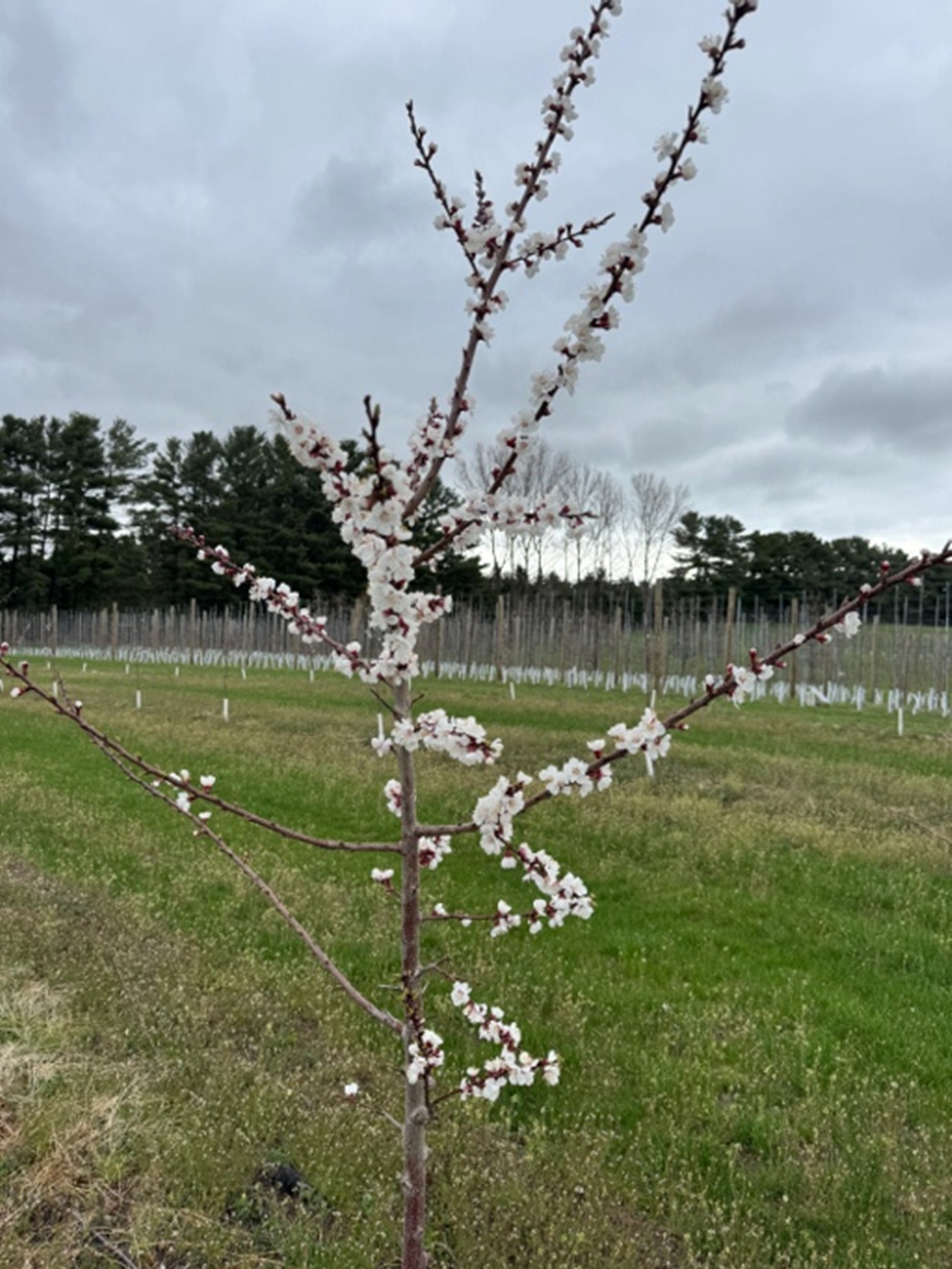
Both tart cherry varieties have moved out of green tip into early tight cluster in Balaton and late bud swell in Montmorency. Potomac and Bartlett pears are at bud burst. There is a slight differentiation in sweet cherry between varieties: Emperor Francis is at early tight cluster, Gold at tight cluster and Ulster at early bud burst. Gala apples are at tight cluster and Honeycrisp are at early tight cluster. Peach blossoms are just beginning to open, and our new apricot planting is blooming on certain varieties.
In southwest Michigan, there is some damage in strawberry and blueberry, but there will still be a decent crop. Plums and peaches are at shuck split. Bloom is ending in sweet and tart cherry. Apples are in full bloom. Small fruitlets are showing up in pear.
Southeast Michigan is in full bloom in apple, and there is only marginal damage in isolated orchards from the earlier April freeze event. There is a lot of variability in damage in peaches depending on variety and when they were in bloom with the April freeze, but growers are reporting little to no fruit from the January cold.
In west central Michigan, plum, tart cherry, sweet cherry and peaches are in bloom. Early apple varieties are at king bloom, and Honeycrisp is at open cluster. There is not much insect activity yet, only green fruitworm has been trapped. Freeze damage to buds is still being evaluated, but tart cherries seemed to have been impacted the most. Apples are in pink on the Ridge with some early king blooms open last Friday, April 24.
Disease report
Apple scab is still the most important disease right now. We are in a pattern of wet weather and expanding green tissue, so be on top of spraying to protect from scab. The weather is forecasted to dry off after this current wet weather system moves out later today. We applied a scab cover on Friday, April 24, before the rain event that evening.
Continue to protect tissue as it opens. EBDCs and captan are good broad-spectrum materials for early in the season. Scala and Vanguard are also good materials that move systemically in the plant. These two fungicides have good activity in cooler weather, so early spring is the best time to use them. George Sundin, PhD, at Michigan State University reminded us at an IPM kickoff meeting to get the early season sprays on for scab to prevent managing the disease throughout the whole season.
Insect report
Insect activity remains low with our cool weather. We caught green fruitworm again this week, even with the cooler temperatures: 0, 7 and 8 moths in each of our three traps. We did not catch American plum borer, oriental fruit moth or black stem borer.
The Michigan State University Extension fruit team had a good conversation recently about native pollinators. There have been lots of reports of bumble bee activity in orchards and fields over this last week. These native pollinators often fly at cooler temperatures than our managed honey bees. These native pollinators may be critical to providing pollination services this year if the forecast turns out to be as cool as they are predicting.
This work is supported by the Crop Protection and Pest Management Program [grant no 2024-70006-43569] from the USDA National Institute of Food and Agriculture. Any opinions, findings, conclusions, or recommendations expressed in this publication are those of the author(s) and do not necessarily reflect the view of the U.S. Department of Agriculture.