The Great Lakes’ most unwanted: New GLANSIS StoryMap highlights top 10 aquatic invaders
 Print
Print Email
EmailAquatic invasive species are a big deal for a few reasons — they can harm the environment, cost us a lot of money, and can even be a risk to our health.
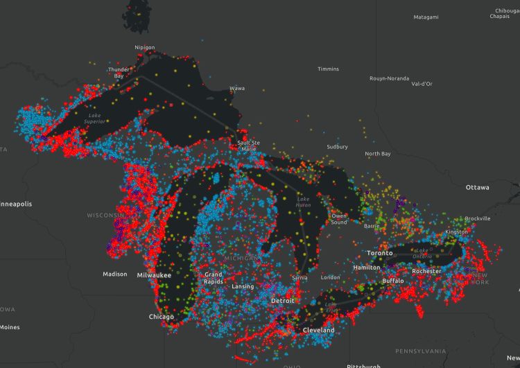
There are nearly 200 introduced aquatic plants, fish, invertebrates, and microorganisms present in the Great Lakes, but which of these species are worst for the ecosystems around them? A new ArcGIS StoryMap built by the Great Lakes Aquatic Nonindigenous Species Information System (GLANSIS) team provides an interactive guide to the top 10 most damaging aquatic invasive species (AIS) in the region. This StoryMap builds on a recent GLANSIS publication in the Journal of Great Lakes Research, and serves as a multimedia introduction to some of the most notorious AIS in the region for educators and students alike.
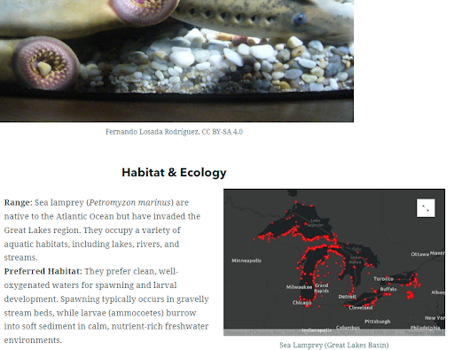
The original paper, “The Great Lakes’ Most Unwanted: Characterizing the Impacts of the Top Ten Great Lakes Aquatic Invasive Species” (Lower et al 2024), is an open-access paper using GLANSIS data to rank the top 10 most harmful invasive species in the Great Lakes, based on their negative environmental and socio-economic impacts. By comparing the impact scores for each species based on the GLANSIS organism impact assessment tool, 10 species emerged as especially harmful: zebra mussel (Dreissena polymorpha); quagga mussel (Dreissena bugensis); alewife (Alosa pseudoharengus); sea lamprey (Petromyzon marinus); Japanese stiltgrass (Microstegium vimineum); grass carp (Ctenopharyngodon idella); water chestnut (Trapa natans); common reed (Phragmites australis australis); round goby (Neogobius melanostomus); and white perch (Morone americana).
The Great Lakes’ Most Unwanted StoryMap includes photos, distribution maps, and impacts of these 10 AIS in an interactive format designed to facilitate classroom learning and the development of environmental science lesson plans. These 10 species represent a range of plants and animals originating from different continents and arriving through different pathways of introduction, and provide a snapshot of some of the most dramatic impacts invasive species can have on an ecosystem. To learn more, explore the StoryMap, read the paper, and check out species profiles and other tools on GLANSIS. For any inquiries or additional information, please contact GLANSIS at oar.glerl.glansis@noaa.gov or follow us on X.
Michigan Sea Grant helps to foster economic growth and protect Michigan’s coastal, Great Lakes resources through education, research and outreach. A collaborative effort of the University of Michigan and Michigan State University and its MSU Extension, Michigan Sea Grant is part of the NOAA-National Sea Grant network of 34 university-based programs.
This article was prepared by Michigan Sea Grant under award NA22OAR4170084 from the National Oceanic and Atmospheric Administration, U.S. Department of Commerce through the Regents of the University of Michigan. The statement, findings, conclusions, and recommendations are those of the author(s) and do not necessarily reflect the views of the National Oceanic and Atmospheric Administration, the Department of Commerce, or the Regents of the University of Michigan.