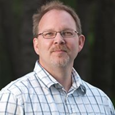
Jay Samek
Jay Samek is the senior scientist in the Global Observatory for Ecosystems Services (GOES) laboratory under the direction of Dr. David L Skole. Jay holds degrees in geography from Dartmouth College (B.A. 1987) and MSU (M.A. 1998). His expertise is in human-environment interactions, social forestry, forest carbon and climate change, and international development. Jay also has more than 20 years of professional experience in geospatial (GIS, Remote Sensing) analysis. His international work stared with the US Peace Corps/Philippines (1987 – 89) and has included research and development projects in the following countries: Laos, Thailand, Cambodia, Vietnam, Malaysia, Indonesia, India, Kenya, and Malawi. His work has been funded by NASA, USAID, World Bank, and UNDP GEF. Transforming basic science into applied actions is fundamental to Jay’s work at GOES.
Education
B.S. in Geography, 1987, Dartmouth College
M.A. in Geography, 1998, Michigan State University
Research and Development Projects
USAID LESTARI (Indonesia) 2016 – 2020. Academic curriculum development in collaboration with University of Palangka Raya and Muhammadiyah University of Palangka Raya focused peatland forest restoration and climate change. Project lead for MSU sub-contract: e-learning development, capacity building, social forestry and forest carbon measurement and monitoring.
USAID PERFORM (Malawi) 2014 – 2017. Support to Government of Malawi for REDD+ capacity building, development of NFI, activity data mapping. Training and capacity building in remote sensing.
US NASA LCLUC 2014 – 2018. Monitoring and mapping the area, extent and shifting geographies of industrial forests in the tropics: India, Malaysia, Thailand, Indonesia and Vietnam. Remote sensing technical lead.
USAID Forest-PLUS (India) 2012 – 2017. Support to Government of India for REDD+ capacity building, development of NFI, activity data mapping. Training and capacity building in remote sensing.
US NASA LCLUC 2008 – 2012. Land Cover and Land Use Change and Its Effects On Carbon Dynamics In Monsoon Asian Region
Governors Climate and Forest Fund. 2015 – 2016. Sub-national Capacity Building for GCF Provinces to Conduct Forest Carbon Inventory – six provinces in Indonesia.
Governors Climate and Forest Fund. 2014 – 2015. Strengthening Indonesian Capacity for Developing National Forest Carbon Inventory, Mapping and MRV Technical Systems – East Kalimantan.
Asia Pacific Network for Global Change Science. 2010 – 2013. Developing an MRV System for REDD+: Scaling up from project level to a national level REDD + MRV systems for Laos and Vietnam.
Asia Pacific Network for Global Change Science. 2009 – 2010. Developing Small-holder Agro-forestry Carbon Offset Protocols for Carbon Financial Markets - Twinning sustainable livelihoods and climate mitigation – Thailand.
GEF 2009 – 2012. Carbon, Conservation, and Livelihoods – Kenya. Support to Government of Kenya for REDD+ capacity building, development of NFI, activity data mapping. Training and capacity building in remote sensing.
Publications
Samek, J. H., Teguh,R., Skole, D. L., Segah, H., Maimunah, S. (2019). Geography, E-Learning and a Course in Peatland Ecosystems and Climate Change Science. ICCETIM 2019. ScitePress.
Samek, J. H., Skole, D. L., Thongmanivong, S., Lan, D. X., & Van Khoa, P. (2013). Deploying internet- based MRV tools and linking ground-based measurements with remote sensing for reporting forest carbon. APN Science Bulletin (Issue 3, 4).
Laosuwan, T., Uttaruk, P., Navanugraha, C., Butthep, C., Samek, J. H., & Skole, D. L. (2012). Carbon sequestration and offset: The pilot project of carbon credit through forest sector for Thailand. International Journal of Environmental Sciences, 3(1), 126.
Samek, J. H., Silapathong, C., Navanagruha, C., Abdullah, S. M. S., Gunawan, I., Crisostomo, B., ... & Salas, W. A. (2012). Land use and land cover change in Southeast Asia. In Land Change Science (pp. 111-122). Springer, Dordrecht.
Samek, J. H., Skole, D. L., Butthep, C., Navanugraha, C., Uttaruk, P., & Laosuwan, T. (2011). Inpang carbon bank in northeast Thailand: a community effort in carbon trading from agroforestry projects. In Carbon sequestration potential of agroforestry systems (pp. 263-280). Springer, Dordrecht.
Skole, D. L., Samek, J. H., & Smalligan, M. J. (2011). Implications of allometry. Proceedings of the National Academy of Sciences, 108(4), E12-E12.
Samek, J.H., Skole, D.L., Lan, D.X., Gunuwan, I., Karsidi, A., Mastrura S. A., S., Thongmanivong, S., Sanjaya, H. 2009. Land Cover Change Dynamics. In Lebel et. al. (eds.) 2009 Critical States: Environmental Challenges to Development in Monsoon Southeast Asia. SIRD, Malaysia.
Tottrup, C., Rasmussen, M.S., Samek, J., Skole, D.L. Towards a generic approach for characterizing and mapping tropical secondary forests in the highlands of mainland Southeast Asia, International Journal of Remote Sensing 6 (2007), pp. 1263–1284.
Samek, J. H., Skole, D. L., & Chomentowski, W. (2004). Assessment of impact of the December 26, 2004 tsunami in Aceh Province Indonesia. Center for global change and earth observations.
Skole, D.L., Chomentowski, W., Samek, J. 2000. Spatial and Temporal Dynamics of Land Use and Cover Change in Tropical Developing Countries: Drivers, Landscape Outcomes, and Effects. AAG Annual Meeting, 2000 Conference Proceedings Pittsburgh, Pennsylvania.
Samek, J. H. (1999). Understanding the failure of Philippine reforestation: A case study in divergent land use practices and environmental perceptions. Michigan State University. East Lansing, MI.


 Print
Print Email
Email